| Schwierigkeit |
mittel
|
|
Aufstieg
|
236 hm |
|
Abstieg
|
302 hm |
| Tiefster Punkt | 733 m |
| Höchster Punkt | 886 m |
|
Dauer
|
8:00 h |
|
Strecke
|
27,6 km |
Wildsteig (or Steingaden) to Buching

Quelle: Macs Adventure, Autor: Minna Harshbarger
Die Tour
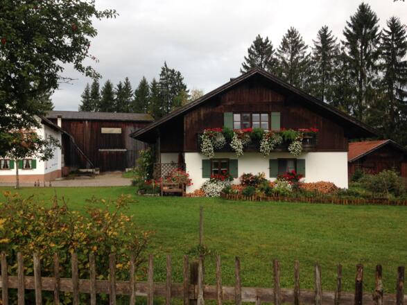
Cross meadows with Alpine views, before reaching the UNESCO Site of Wieskirche, a baroque masterpiece of space and light with magnificent frescoes, before walking to Buching.
Today you can choose between two variants of the King Ludwig Way; a slightly shorter route via the Bavarian villages of the Trauchgau, or a longer walk across moorland and via Steingaden. These directions follow the route via Steingaden. NOTE: if you stayed in Steingaden last night instead of Wildsteig, you will follow this trail by default and you should follow the turn by turn directions from 9.8km. If you spent last night in Peiting, your included taxi transfer will bring you to the trailhead in Wildsteig where you will continue the walk to Buching, following either the route via Steingaden as detailed here, or the shorter route via Trauchgau (the turning point of which is at approx. 5.5km along this trail and is mentioned in the turn by turn directions).
Although today's walk via Steingaden is the longer one, it doesn't involve a lot of ascent - in fact there is more descent than ascent. You'll pass through a lot of forest land and some scenic pastureland. As with other days, way-marking of the route is generally good. However, it is a bit less plentiful after Steingaden. Note that you will need to leave the KLW near the end of the route to get to Buching.
There are few shops on route to buy food and drink. Make sure to bring plenty of water for the day's walk. There are also a number of restaurants and cafés enroute at Wies, Steingaden, Urspring and Prem.
Info
Karte
Details
|
Kondition
|
|
|
Erlebnis
|
|
|
Landschaft
|
|
| Technik |


